

Connected
We live in a beautiful corner of Somerset, in the middle of one of the richest prehistoric landscapes in western Europe.
Looking out from our kitchen window I see Penselwood, a wooded ridge a couple of miles away, running north/south along the Somerset / Wiltshire border. In times past, when it was cleared, we would have seen a small Iron Age hillfort there. This would have been visible from the neolithic causewayed enclosure and Bronze Age barrow dug in the chalk of Whitesheet Hill, to the east, on the western edge of Salisbury Plain.
In 878, Alfred gathered the fyrd under an old oak in the forest now straddling the ridge - Selwood - to fight the Danes at Edington, on the northern escarpment of the Plain. It was the furthest west the Danes ever got.

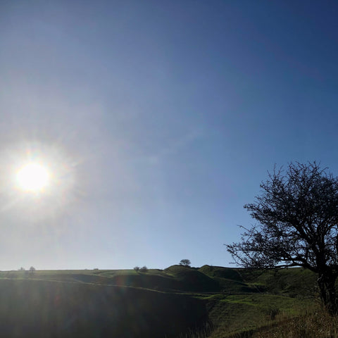
I had a lovely walk with Woody around the site of the battle on Saturday. No-one's sure exactly where it was, but Alfred's victory is celebrated by the Westbury White Horse, carved into the hillside much later. This hillside is no ordinary slope; the top section morphs into the outer bank of a magnificent iron age hill fort - Bratton Camp - one of three along the northern flank of Salisbury Plain. This itself was built around a neolithic long barrow, which predates it by 3,000 years. To the east are Patcombe Hill,rising from Edgecombe Bottom (photo), and Edington Hill, both peppered with burial mounds and strip lynchets.
The Iron Age hill forts of the North Wessex scarp - Scratchbury, Battlesbury, Bratton, Uffington and Liddington - feature in David Abram's fascinating new book, the Aerial Atlas of Ancient Britain.
 I went to a talk he gave a couple of weeks' ago; his aerial photography and the legwork he has put in - intellectual and physical - gives a new perspective.
 I've been a keen amateur archaeologist over the years, but even so, I'll be looking at these landscapes - many local - with fresh eyes.
David reinforced a key problem I've been banging on about for years; our current - and novel - lack of connection with the landscapes we live in. Without it, how can we be connected with the natural world around us too?
For thousands of years, generation after generation lived in the same places, met by the same stones, and gathered in the same ceremonial sites, usually laboriously and intricately built. When a new wave of immigrants arrived or circumstances changed, people often adapted existing sites. You can easily imagine the strong understanding of place and belonging there must have been.
 Earth, sky, water. Any analysis of the sites they left behind shows how deeply embedded people were in the natural world around them.
 It's absolutely unsurprising. They relied on an intimate understanding of their surrounding geography to survive and prosper. Rivers, for example, seemed to have had a ritual significance in the neolithic that matched their practical importance as food sources and transport networks.* The places where the elements seemed to meet often had a particular resonance, which we can still understand today.
Understanding more about our prehistory and earliest history is a key we can all use to help unlock the secrets of our landscape. And not just that - the natural world around us too. As David Abram says:
These wonders are hidden in plain site all around us... (they) may fundamentally alter the way you think and feel about the land beneath your feet.
*Their travels are astounding. A ceremonial axehead found on the Sweet Track, down the road outside Glastonbury, came from the Italian Alps. Nearly 6000 years ago.